Bells Corners, Ottawa
Bells Corners is a community on the west side of Nepean that is entirely surrounded by the Greenbelt. Originally named after Hugh Bell the community remained mainly rural until the early 1900's. However, by 1950's the community had become the commercial center for the surrounding rural areas. The majority of residents of Bells Corners speak English as their primary language.
Housing Statistics
Oldest house: Built in 1832.
Average house age: Most houses were built between 1958 to 1990.
Detached homes: 59% of homes are detached. 41% are row and semi-detached homes.
House prices - detached homes*: Recent sales vary from $250,000 to $500,000 with 73% under $400,000.
House prices - semi-detached homes and row houses*: Recent sales vary from $230,000 to $350,000.
Have us help you find a home in this area.
Recreational Opportunities
Bells Corners' location creates unique recreational activities. It is surrounded by the Greenbelt giving residents access to huge, open spaces and a large network of cross country skiing trails that surround the community and continue into other areas of the city. Along with the Greenbelt there are several parks in the area that have baseball diamonds, basketball courts, sports fields, outdoor hockey and skating rinks, a tennis court, and a volleyball court. The community also has an outdoor pool and wading pool, play structures, and a splash pad. The Nepean Arts Centre provides space for dance, theatre and music to be learned and mastered and also provides spaces to rent for the residents.
What we love about Bells Corners:
- The community is surrounded by the Greenbelt giving the residents an above average amount of greenspace and provides access to a large network of cross country skiing trails
- The community is located between Kanata and the rest of the city and located beside major highways which makes it easy to travel anywhere in the city
Schools in Bells Corners:
Churches in Bells Corners:
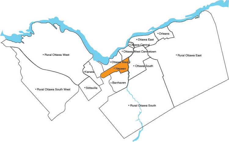
Where is Bells Corners?
Bells Corners is in Nepean.

Here is a more detailed map of the area:
